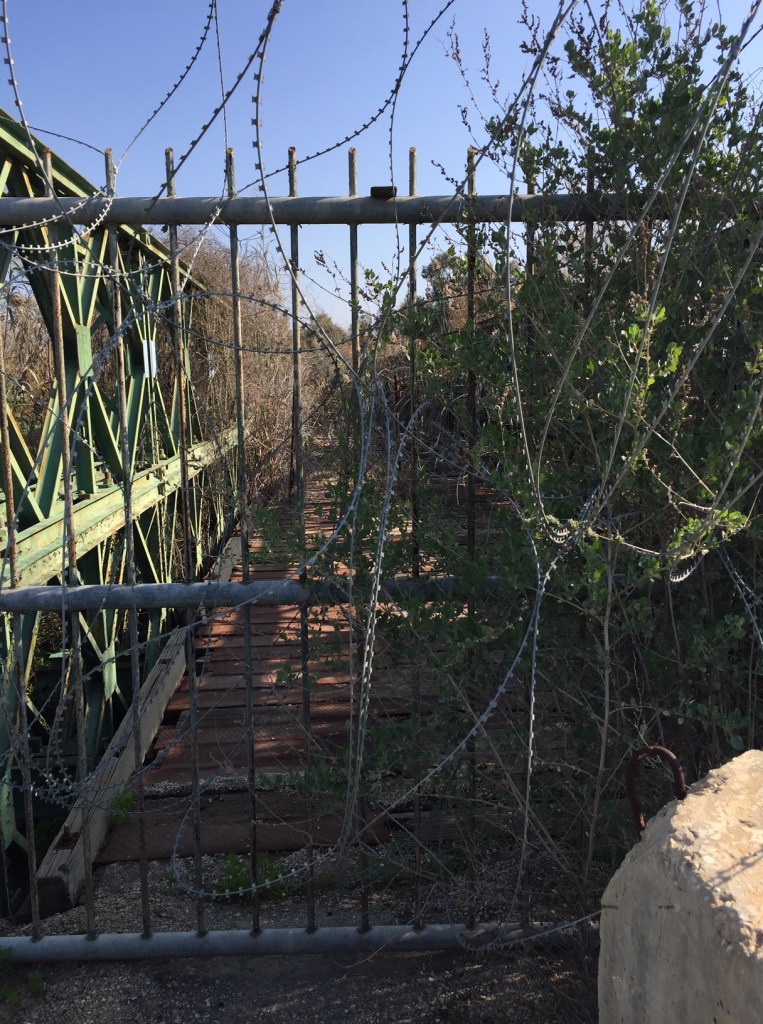
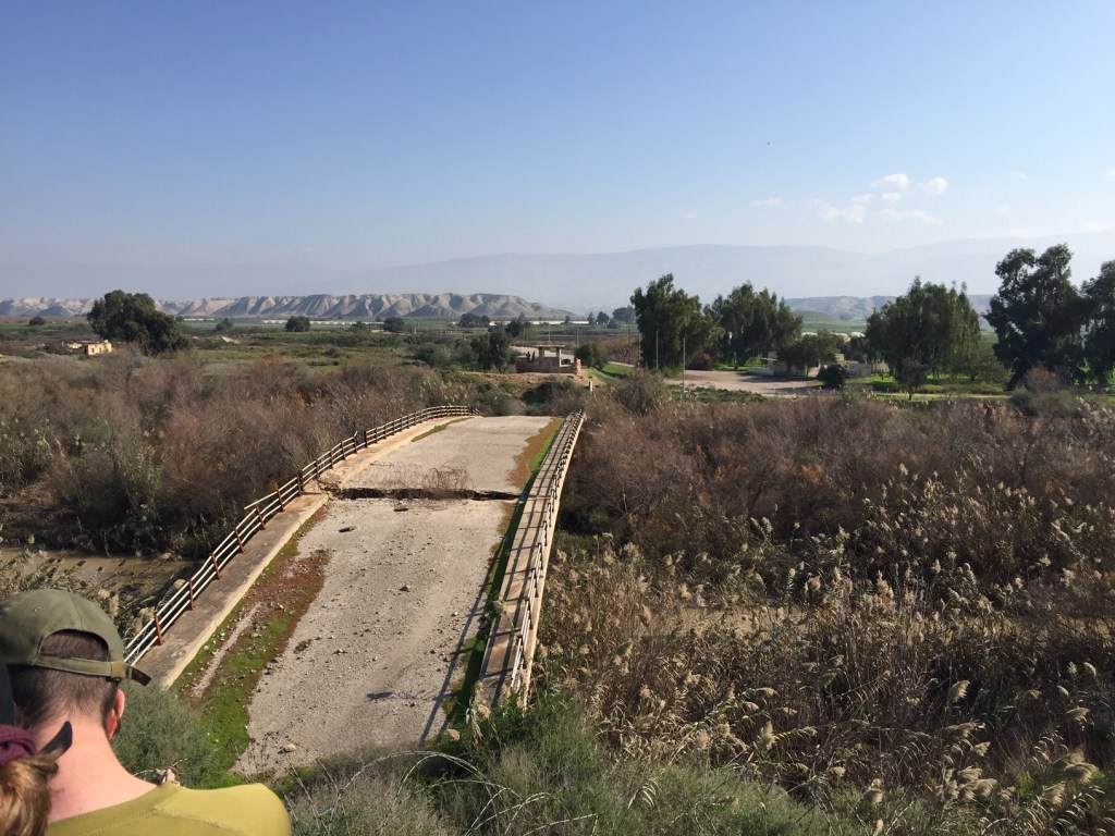
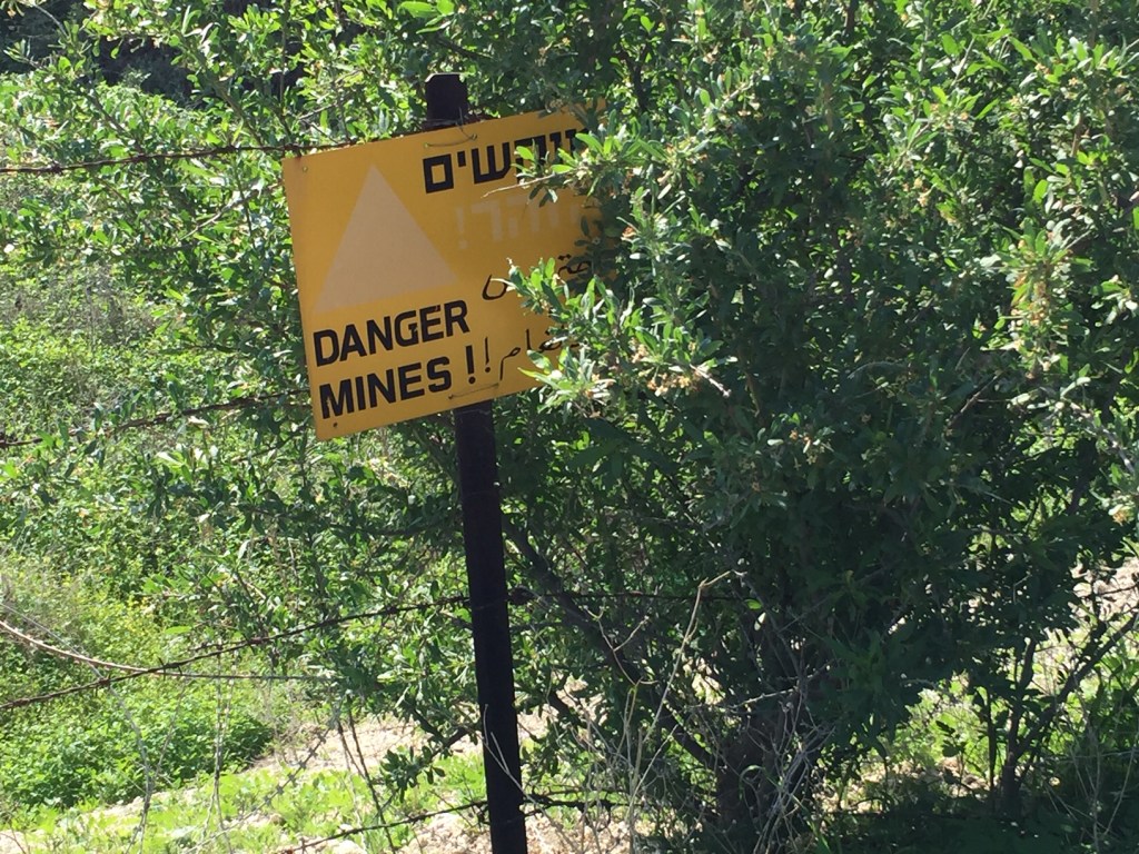
In early February, a few days after I had returned from a brief trip to snowy Kalamazoo, Michigan for my sister-in-law’s memorial service, I traveled with a group of Pardesnikim on a two day tiyyul to north central Israel. Although the stated intention of our trip was to trace the history of the kibbutz movement, our religious Zionist tour leader, moved by the recent announcement of the Trump “peace plan”, decided to take us first into the West Bank to the site of an old border crossing between Israel and Jordan. We drove down the hillside to within sight of Yam HaMelach (the Dead Sea), then proceeded northward and made our way into a closed military area which we had received permission to enter. There, we were accompanied by a bevy of soldiers to view the Damia Bridge, known in Israel as Gesher Adam (Adam Bridge — or perhaps, The People’s Bridge).
Wiki can tell you what our tour guide told us: “After 1991 it was used only for goods transported by truck between Israel, the West Bank and Jordan until its closure for security reasons some time between 2002 and 2005 during the Second Intifada. As of 2014, the Israeli side is part of a closed military area.The site was used as a crossing between the west and east banks of the Jordan due to good access in both directions over the Far’a[2]/Tirzah Valley to the west and the Zarqa/Yabbok Valley to the east.
Still visible are ruins of several consecutive bridges:[3] the stone bridge built by the Mamluk sultan Baibars in the 13th century, blown up by Haganah forces during Operation Markolet (known as the Night of the bridges) on the night of 16–17 June 1946; a British bridge built soon after, and a Jordanian one from the 1950s, both destroyed by the Israeli army during the 6-Day War of 1967. Right after the war, in August 1967, Israeli Minister of Defense Moshe Dayan allowed the uncontrolled traffic of goods between the Palestinians and Jordan using the ford of Damiya, as a way of avoiding the economic collapse of the West Bank and for avoiding Palestinian discontent, since the Israeli markets were not open yet to Palestinian produce. This was an element of what became known as the “policy of the open bridges”.[4]“
I know that feelings about our visit to this bridge, and about the Trump plan, are varied among my fellow students. In general, the students at Pardes are more left-leaning than the faculty (many of whom live in what you or I mightcall “settlements” in what we refer to as the West Bank). But this is not true of all of us — and there are also gradations of left-ness, as well. I know that in this blog I’ve skirted the Israel/Palestine issue somewhat. I never did post my pictures and reflections on our tiyyul to Hebron back in the fall — it raised so many questions for me that I found it hard to know where to begin. I can only tell you that the way the conservative Zionists remember history seems always to be tinted with a rosy glow of nostalgia (“in the old days we got along so well with the Arabs”), and perhaps with a golden haze of military triumph as well. And yet, would it be better to have this bridge open to commercial traffic? I think yes. The question is, who should in charge of that traffic flow — Israel, or the Palestinian Authority? Jordan has little enthusiasm for either option. If the next government follows the Trump plan which would allow Israel to annex these contested lands, will this bridge reopen? Hard to say.
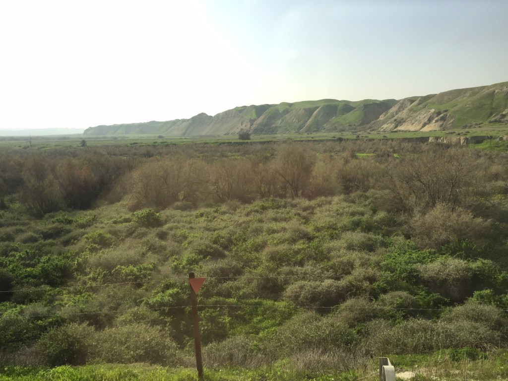
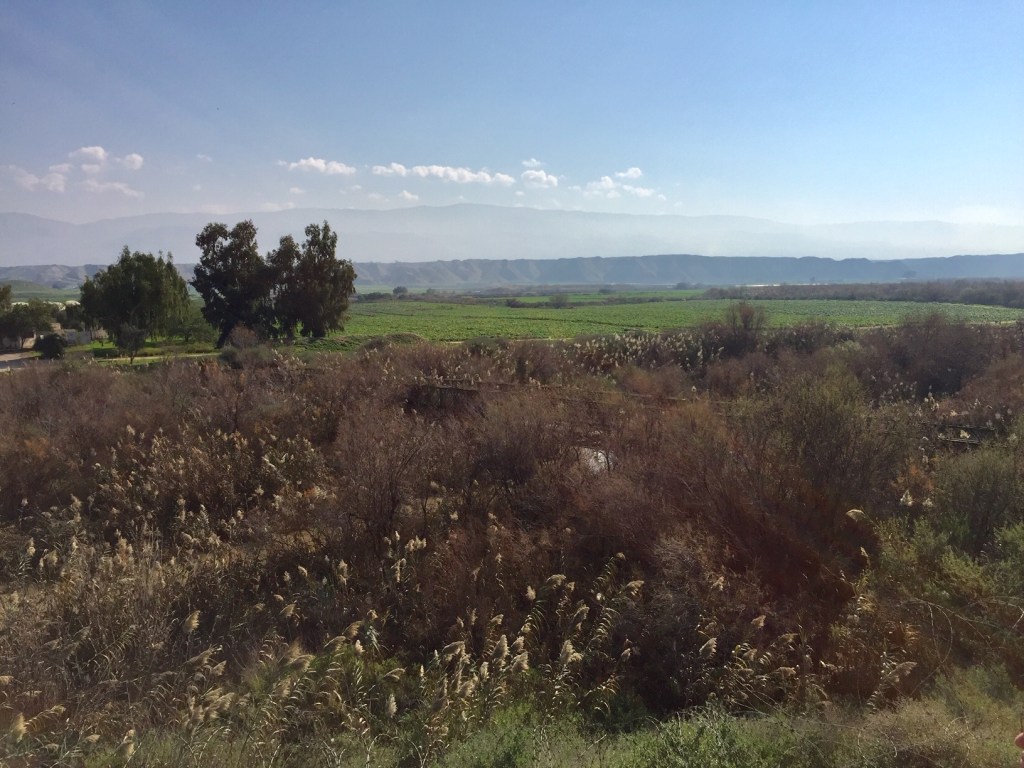
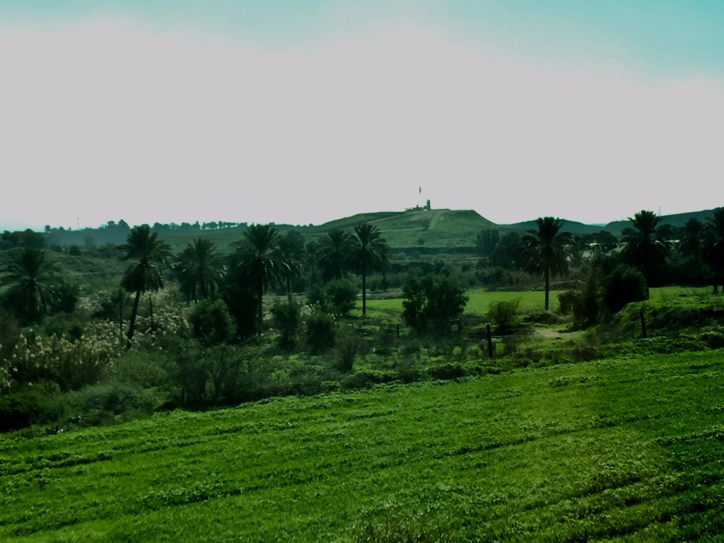
From the bridge we drove north. The weather was perfect, and everything was glowing green with the first flush of spring. We passed through farm fields, some farmed by Palestinians and some by Israelis. The fertility of this land, and its access to water, is part of what makes it desirable. You can see in this map from Peace Now https://peacenow.org.il/en/data-on-netanyahus-jordan-valley-annexation-map that where we were driving is exactly what Netanyahu (and others) proposes to annex, with full support of Trump’s government. One can make an argument — a strong one –that Israel is historically entitled to these lands. One can also make an argument that the Palestinians need a place to live, and that much of this land has been in their possession for centuries. I wish I could tell you that I think this is clear and uncomplicated…What I can say for sure is that the large majority of Israelis are center right, and do not support an organization like Peace Now.
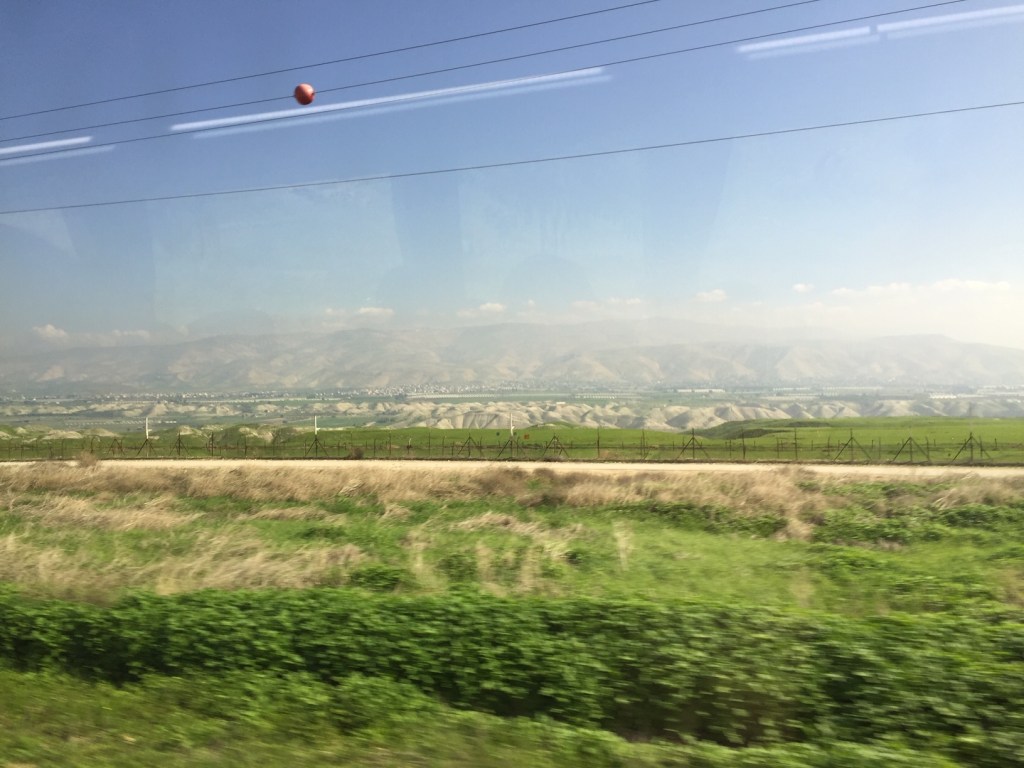
After we came through the checkpoint at the “Green Line”, we stopped at a small convenience store for a snack and a pee. Everything was peaceful, sunny, normal. Still, when we boarded the bus again, the last view before we disembarked and began our hike was another piece of contested ground — the area known to Israelis a the Island of Peace. The Jordanian flag is flying there now, for the first time since the early nineties. You can read more here: https://www.nytimes.com/2019/11/10/world/middleeast/jordan-israel-lease-land.html